Original: $18.06
-70%$18.06
$5.42The Story
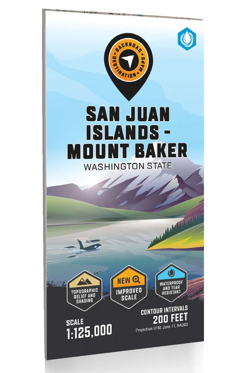
San Juan Islands - Mount Baker Recreation Map
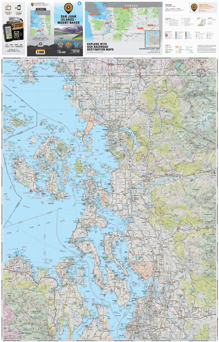
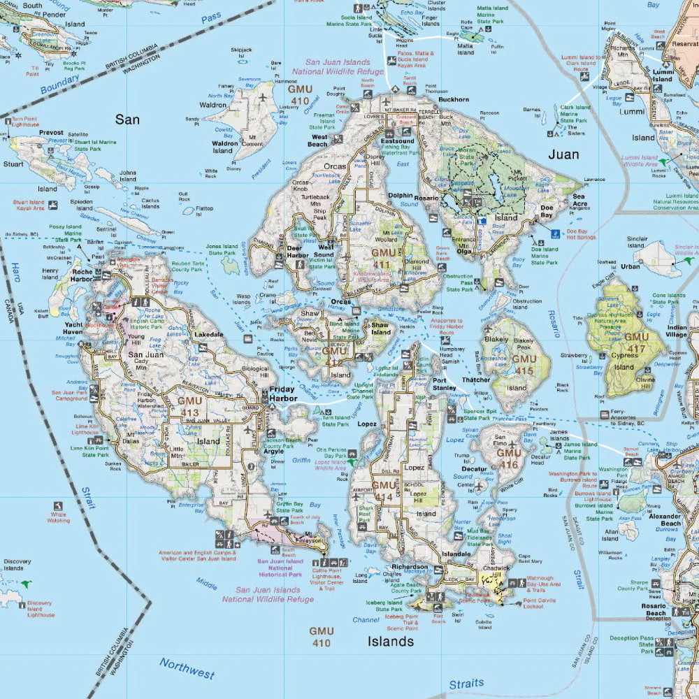
Covering the San Juan Islands and Puget Sound area to the east of Mount Baker, this topographic recreation map highlights all of the nearby access roads and includes multi-use trails for hikers, mountain bikers, horseback riders, cross-country skiers and snowshoers along with motorized trails for ORVers and snowmobiles, fishing lakes and rivers, notable recreation areas, campgrounds, day-use areas, viewpoints, backcountry campsites, backcountry huts and more.
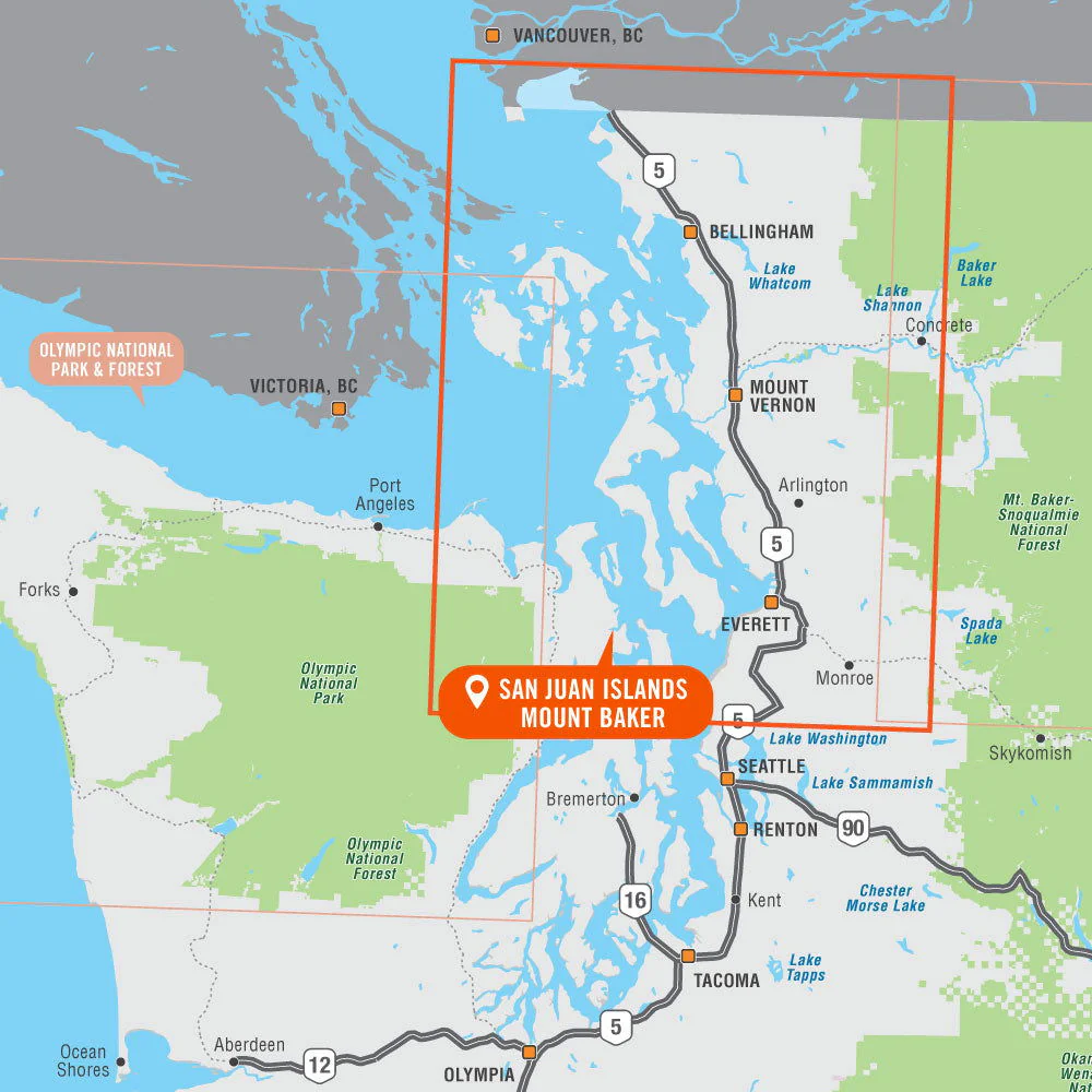
With industry-leading cartographic detail and special features including federal BLM, regional and DNR state owned land, private land and national forests, countless roads, trails and recreational Points of Interest, you won't find this level of recreational information anywhere else! Using 1:24,000-1:66,000 scale water and road data, this map covers 6,735 square miles and includes Anacortes, Bellingham, Edmonds, Everett, Ferndale, Friday Harbour, Lynden, Marysville, Mount Baker, Mount Vernon, Oak Harbor, Point Roberts, Port Townsend, Puget Sound, San Juan Islands, Sedro-Woolley, and much more!
TThe printed version of the map is displayed at 1:125,000 scale on 36 x 56.2 inch paper on a durable waterproof synthetic material. There is the option to get this as a lightweight folded map or in the wall map version which is designed to fit into standard picture frame sizes to hand on your home, office or cabin wall.
Print Features:
- Printed on a durable waterproof and tear-resistant material
- Includes industry leading cartographic detail and state-of-the-art relief shading
- Countless points of interest, hiking trails, campsites, boat launches, paddling routes and more!
- Easy to read, large-scale 36 x 50 inch map at 1:125,000 scale
- Seamless map coverage requires no page turning
Details & Craftsmanship
Every detail has been carefully considered to bring you the perfect product.
Details & Craftsmanship
Every detail has been carefully considered to bring you the perfect product.
Details & Craftsmanship
Every detail has been carefully considered to bring you the perfect product.
Description
San Juan Islands - Mount Baker Recreation Map
Covering the San Juan Islands and Puget Sound area to the east of Mount Baker, this topographic recreation map highlights all of the nearby access roads and includes multi-use trails for hikers, mountain bikers, horseback riders, cross-country skiers and snowshoers along with motorized trails for ORVers and snowmobiles, fishing lakes and rivers, notable recreation areas, campgrounds, day-use areas, viewpoints, backcountry campsites, backcountry huts and more.
With industry-leading cartographic detail and special features including federal BLM, regional and DNR state owned land, private land and national forests, countless roads, trails and recreational Points of Interest, you won't find this level of recreational information anywhere else! Using 1:24,000-1:66,000 scale water and road data, this map covers 6,735 square miles and includes Anacortes, Bellingham, Edmonds, Everett, Ferndale, Friday Harbour, Lynden, Marysville, Mount Baker, Mount Vernon, Oak Harbor, Point Roberts, Port Townsend, Puget Sound, San Juan Islands, Sedro-Woolley, and much more!
TThe printed version of the map is displayed at 1:125,000 scale on 36 x 56.2 inch paper on a durable waterproof synthetic material. There is the option to get this as a lightweight folded map or in the wall map version which is designed to fit into standard picture frame sizes to hand on your home, office or cabin wall.
Print Features:
- Printed on a durable waterproof and tear-resistant material
- Includes industry leading cartographic detail and state-of-the-art relief shading
- Countless points of interest, hiking trails, campsites, boat launches, paddling routes and more!
- Easy to read, large-scale 36 x 50 inch map at 1:125,000 scale
- Seamless map coverage requires no page turning