The Story
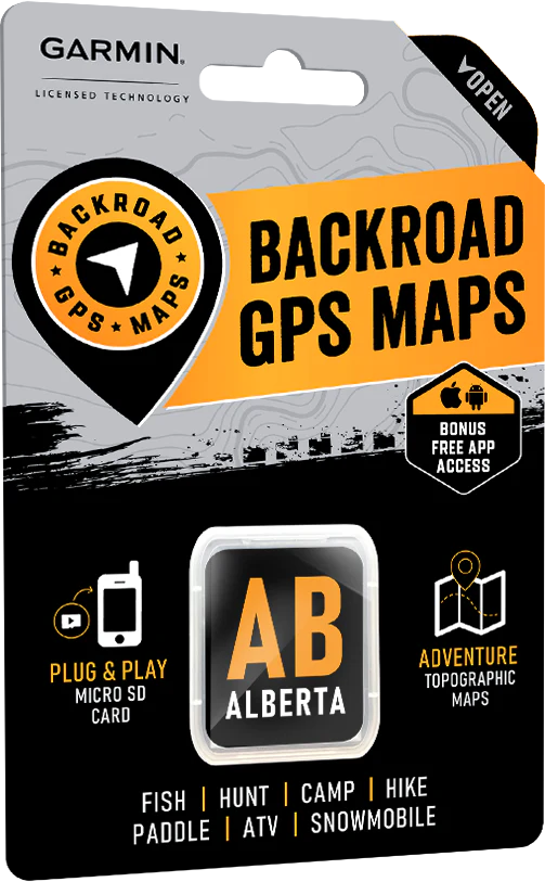
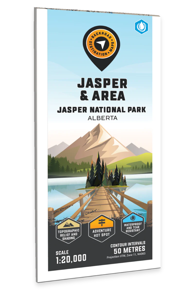
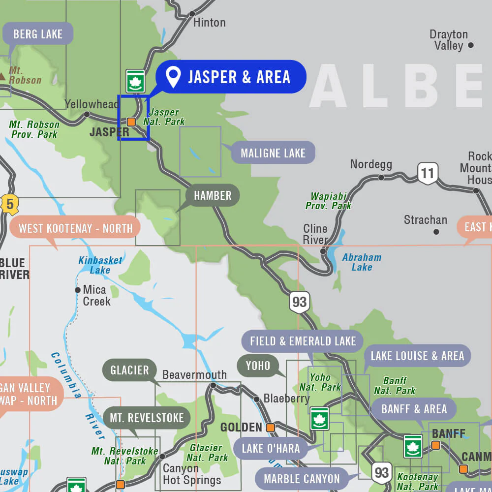
Jasper & Area - Jasper National Park Map Alberta
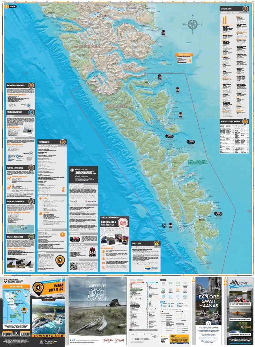
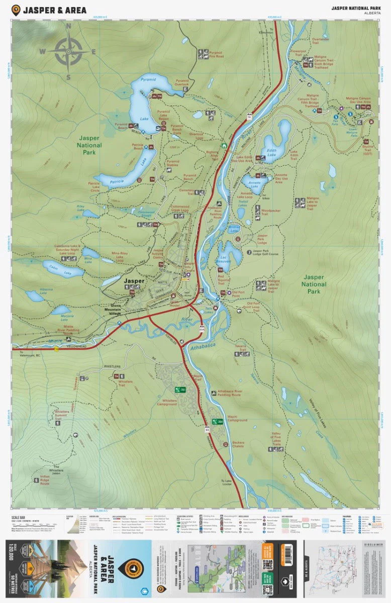
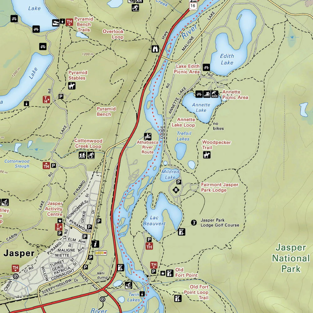
Focusing on the town of Jasper within Jasper National Park Alberta, this BRMB Adventure topographic map charts all the nearby roads, trails for hiking, mountain biking, horseback riding, cross-country skiing and snowshoeing, picnic areas, boat launches, beaches, waterfalls, campgrounds, fishing lakes and rivers, paddling routes and more! This Adventure map features our industry-leading topographic contours and relief shading and includes the areas of Jasper city, Annette Lake, Athabasca River, Cabin Lake, Edith Lake, Maligne Canyon, Miette River, Old Ford Point, Patricia Lake, Pyramid Lake, Valley of Five Lakes, Wapiti Campground, Whistlers Campground and more!
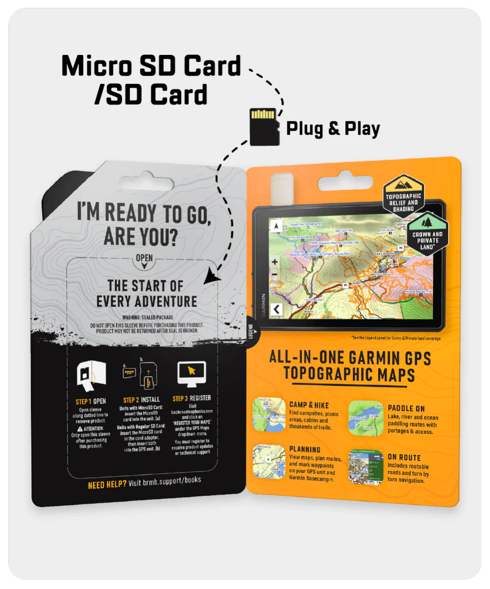
The printed version of the map is displayed at 1:20,000 scale on 61 x 94 cm (24 x 37 in) paper. You can choose between having the map printed on regular water-resistant paper or a more durable waterproof synthetic. The Wall Maps have been customized to display nicely and fit into common picture frame sizes so you can hang on the cabin, home or workshop wall. They are available in three different sizes and come printed on the waterproof synthetic material.
Print Features:
- Printed on regular water-resistant paper or durable waterproof and tear-resistant material
- Includes industry leading cartographic detail and state-of-the-art relief shading
- Countless points of interest, hiking trails, campsites, boat launches, paddling routes and more!
- Easy to read, large-scale 61 x 94 cm (24 x 37 inch) map at 1:20,000 scale
- Seamless map coverage requires no page turning
Details & Craftsmanship
Every detail has been carefully considered to bring you the perfect product.
Details & Craftsmanship
Every detail has been carefully considered to bring you the perfect product.
Details & Craftsmanship
Every detail has been carefully considered to bring you the perfect product.
Description
Jasper & Area - Jasper National Park Map Alberta
Focusing on the town of Jasper within Jasper National Park Alberta, this BRMB Adventure topographic map charts all the nearby roads, trails for hiking, mountain biking, horseback riding, cross-country skiing and snowshoeing, picnic areas, boat launches, beaches, waterfalls, campgrounds, fishing lakes and rivers, paddling routes and more! This Adventure map features our industry-leading topographic contours and relief shading and includes the areas of Jasper city, Annette Lake, Athabasca River, Cabin Lake, Edith Lake, Maligne Canyon, Miette River, Old Ford Point, Patricia Lake, Pyramid Lake, Valley of Five Lakes, Wapiti Campground, Whistlers Campground and more!
The printed version of the map is displayed at 1:20,000 scale on 61 x 94 cm (24 x 37 in) paper. You can choose between having the map printed on regular water-resistant paper or a more durable waterproof synthetic. The Wall Maps have been customized to display nicely and fit into common picture frame sizes so you can hang on the cabin, home or workshop wall. They are available in three different sizes and come printed on the waterproof synthetic material.
Print Features:
- Printed on regular water-resistant paper or durable waterproof and tear-resistant material
- Includes industry leading cartographic detail and state-of-the-art relief shading
- Countless points of interest, hiking trails, campsites, boat launches, paddling routes and more!
- Easy to read, large-scale 61 x 94 cm (24 x 37 inch) map at 1:20,000 scale
- Seamless map coverage requires no page turning